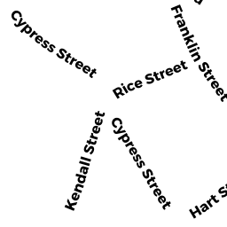
22 HART ST
Owner Information
ROBERTS STREET REALTY LLC
158 CYPRESS ST
BROOKLINE, MA 02445


Property Details
22 HART ST is classified as a Accessory Land with Improvement.
22 HART ST is valued at $97,000. The land is valued at $20,500 and the structures are valued at $0. There is an additional valuation of $76,500 on this property.
This property is in Zone M10. Confirm with local Zoning Board authorities to ensure there are no overlays or other easements on this property.
The most recent deed for 22 HART ST is recorded at the local registrar in Book 31956, Page 571. 22 HART ST was last sold on Wednesday, December 11, 2013 for $1,500,000.
Assessment data from fiscal year 2021.
Flood Data
According to the FEMA National Flood Hazard Layer, this property does not appear to be in a flood zone. It may also be in an area not yet reviewed. Nonetheless, confirm this information prior to taking any action.
To view the flood hazards around this property, create a FEMA "Firmette" Map of the area around 22 HART ST.
Broadband Internet Providers
| Provider | Type | Bandwidth (mbps) | |
|---|---|---|---|
| HughesNet | Satellite | 25 | 3 |
| Viasat Inc | Satellite | 100 | 3 |
| Verizon New England Inc. | DSL | 10 | 1 |
| Comcast | Cable | 1000 | 35 |
| RCN | Cable | 500 | 20 |
| RCN | Cable | 1000 | 20 |
| Starry, Inc. | Fixed Wireless | 200 | 200 |
| netBlazr Inc | Fixed Wireless | 50 | 50 |
| GCI Communication Corp. | Satellite | 0 | 0 |
| VSAT Systems, LLC. | Satellite | 2 | 1 |
Broadband service provider data from December 2020.
Adjacent Properties
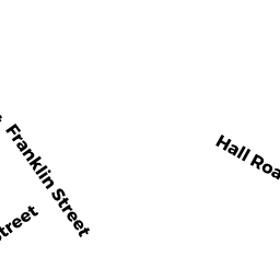
- 51 53 FRANKLIN ST
Two-Family Residential owned by MAHONY THOMAS D & ELLEN W - 19 ROBERTS ST
Three-Family Residential owned by JAFFE LEON D & SHIRLEY - 17 ROBERTS ST 1 P-3
Residential Condominium owned by GRESSER HILARY M - 17 ROBERTS ST 2 & P1-2
Residential Condominium owned by DAY BENJAMIN - 17 ROBERTS ST 3 & P5
Residential Condominium owned by ZHOU HONGYU - 55 FRANKLIN ST
Three-Family Residential owned by ROBERTS STREET REALTY LLC - 20 HART ST
Single Family Residential owned by MARSH MARIE